Abstract:
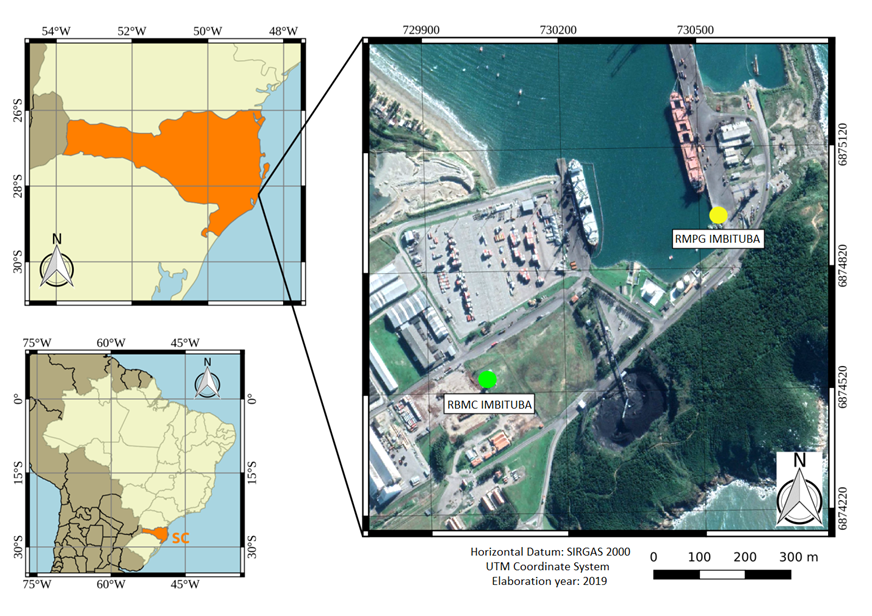
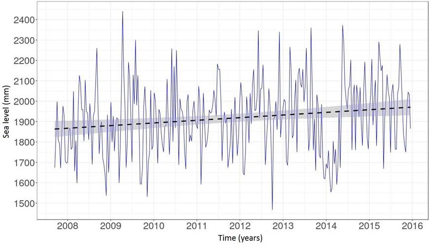
Satellite altimetry missions and tide gauges allow the monitoring of sea level variations over time. While tide gauges monitor sea level relative to a local reference, satellite altimetry missions do so in relation to the Earth’s geocenter. From the comparison between time series generated by these two methods, we observed differences that may be related to possible vertical land movement (VLM). Our objective in this study is to determine the linear trends of VLMs from the difference between the sea level trend found by the satellite altimetry missions TOPEX/Poseidon, JASON 1, 2 and 3 (v SA ) and the sea level trend found by the tide gauge of Imbituba in Santa Catarina (SC), Brazil (v TG ). For this, we demarcated cells along the satellite tracks at a radius of up to 500 km over the ocean from the location of the tide gauge station. The mean values for v SA (1992-2017) and v TG (2002-2015) were 2.5 mm/a ±1.2 mm/a and 5.4 mm/a ±1.9 mm/a, while the mean values for v SA (2007-2015) and v TG (2007-2015) were 7.1 mm/a ±4.6 mm/a and 13.0 mm/a ±4.2 mm/a, respectively. The comparison of VLM obtained between the combination of v SA and v TG and GNSS showed results with better consistency over longer time series.
Keywords:
sea level; vertical land movement; satellite altimetry; Imbituba-SC tide gauge
 Thumbnail
 Thumbnail
 Thumbnail
 Thumbnail
 Thumbnail